Siebert materials independently identify Hamilton as a way station and routing point on lines connecting Cincinnati with West Elkton, Darrtown, Fair Haven, Richmond, Fountain City / Newport, and other destinations. The exact path could vary depending on safety, pursuit, weather, available conductors, and receiving contacts.
Underground Railroad routes were not fixed modern transit lines. The evidence supports recurring corridors, communities, conductors, and handoff points, but individual journeys could change according to danger and circumstance.
Cincinnati: A Southern Gateway
Hamilton's Underground Railroad routes did not operate in isolation. Multiple Wilbur H. Siebert sources place Cincinnati at the southern end of routes that moved north through Hamilton. One route identified Hamilton among the way stations between the Cincinnati / College Hill area and the Stubbs family at West Elkton. Another describes Rev. Rusk traveling through Hamilton at night while conducting freedom seekers toward West Elkton. G. W. Larsh independently remembered a line beginning at Cincinnati and continuing through Hamilton, Darrtown, Fair Haven, Richmond, Fountain City / Newport, and Winchester.
A separate Cincinnati neighborhood study by the Walnut Hills Historical Society helps explain the Black community environment near the southern end of those routes. In the antebellum neighborhood later known as Bucktown, the area around Sixth Street, Broadway, and the Miami Canal contained Black homes, businesses, churches, and institutions. Allen A.M.E. Church stood near the center of that community. The study identifies Henry Boyd's furniture factory nearby and describes Boyd as being at the center of Underground Railroad activity in Cincinnati during the 1840s and 1850s. It also discusses the Dumas House Hotel, the only Cincinnati hotel then serving Black guests, as a place reputed to have Underground Railroad ties.
The Miami Canal ran directly through this neighborhood and connected it with the Ohio River and Cincinnati's commercial transportation system. This does not prove that every freedom seeker bound for Hamilton passed through Bucktown, Allen A.M.E., Henry Boyd's factory, or the Dumas House. Rather, the neighborhood provides documented social and transportation context for the Cincinnati end of a larger network that independent route evidence connects northward through Hamilton.
Cincinnati / College Hill → Hamilton → West Elkton and other northwest routes → Indiana
Cincinnati context source: Walnut Hills Historical Society, “Robert Gordon, businessman.” The article documents Bucktown's Black business and institutional landscape, Allen A.M.E. Church, Henry Boyd's nearby factory, the Dumas House Hotel, and the Miami Canal. Read the source →
Hamilton route evidence: Wilbur H. Siebert research materials, including Siebert 1251, 4534, 1687, 1716, and the Mendenhall route account. These sources are used to establish the Cincinnati-to-Hamilton route connection independently from the Walnut Hills article.
Miami University: A Campus Divided Over Slavery
Oxford belongs on the regional network map for a different reason than Cincinnati or Hamilton. The evidence does not establish Miami University itself as an Underground Railroad station, and the university should not be described as uniformly antislavery. Instead, Miami was a major Presbyterian intellectual center where antislavery and proslavery positions were openly contested.
Historian James H. Rodabaugh describes Miami as virtually a Presbyterian stronghold during its first fifty years. President Robert Hamilton Bishop and professor John Witherspoon Scott were associated with the more antislavery side of the campus disputes, while other faculty members, including William Holmes McGuffey and later president George Junkin, represented more conservative or explicitly proslavery positions. Miami's own archival interpretation likewise emphasizes that university leaders and students participated on different sides of the slavery debate.
The Miami University Anti-Slavery Society was organized on June 12, 1834. Students spoke throughout the region, distributed pamphlets, subscribed to antislavery newspapers, and helped build circulation for James G. Birney's Philanthropist. At the same time, opposition within the university and the Presbyterian Church made Miami a place of conflict rather than consensus.
For the Hamilton project, Miami remains important because people connected to its antislavery debates later appear in Hamilton's religious network. Miami graduates Thomas E. Thomas and Joseph Glass Monfort, both class of 1834, later served First Presbyterian Church in Hamilton and carried antislavery ideas into the wider Presbyterian world. Their presence helps connect Oxford to Hamilton without treating Miami University as a single, unified antislavery institution.
Sources: James H. Rodabaugh, “Miami University, Calvinism, and the Anti-Slavery Movement,” Ohio Archaeological and Historical Quarterly. Read at Ohio History Journal → Miami University Libraries, Miami University and Slavery. Explore the archive exhibit →
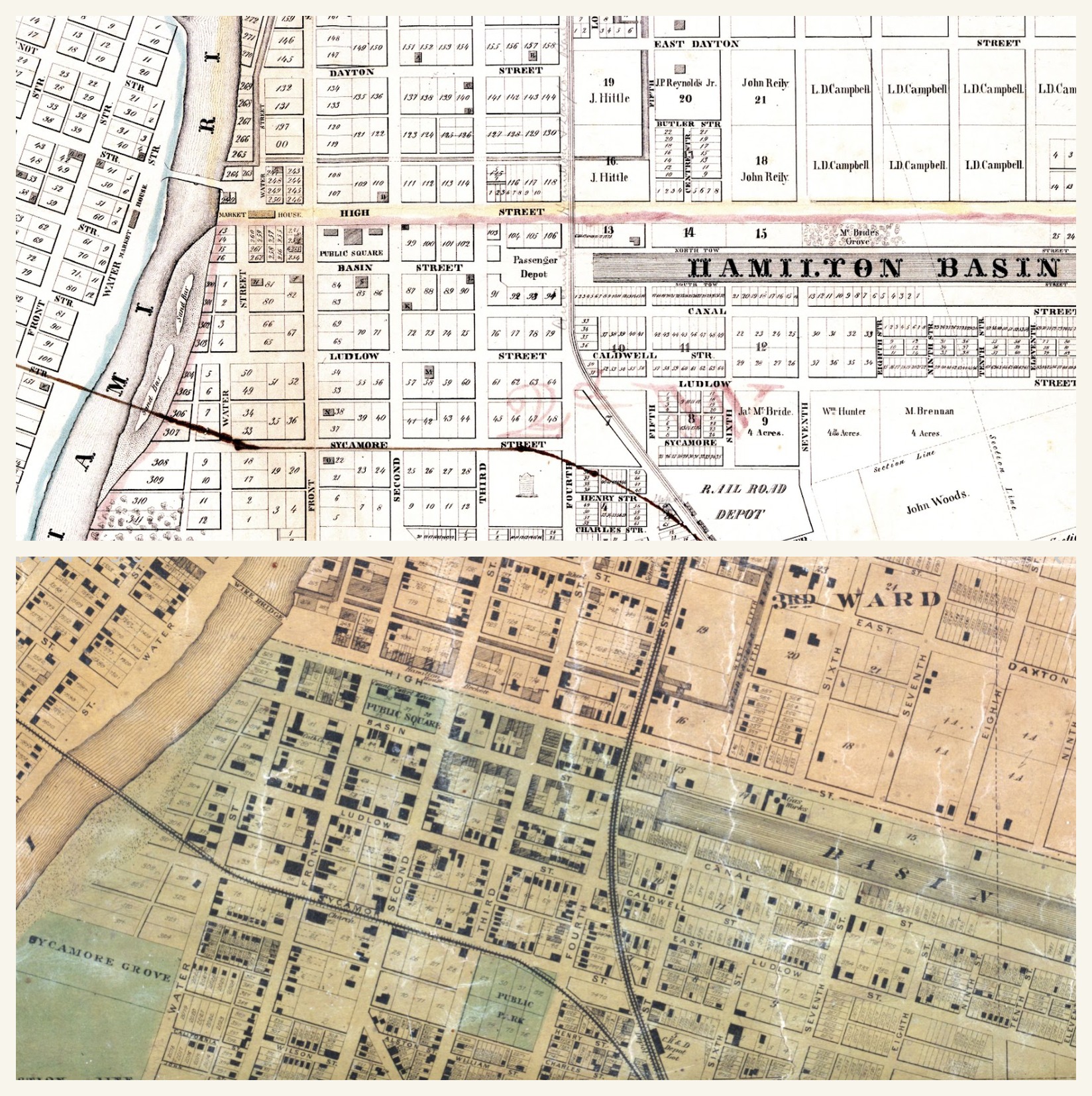
Hamilton Railroad and Canal Basin: Period-Map Correction
Earlier versions of this project used a modern reconstruction based in part on the George C. Crout “Transportation and Power in 1860” map. During historical review, Brad Spurlock and Brian Smith identified a problem with the railroad alignment in that reconstruction. The period maps below show the Cincinnati, Hamilton & Dayton Railroad passing west of the Hamilton Basin, with buildings and lots between the railroad and the basin rather than the railroad crossing the basin.
Morning Sun, Arch McDill, and Eben Elliott
M. M. Brown's recollection of a large group moving through the region around 1842 or 1843 describes pursuit along the road from Hamilton toward Richmond and identifies two families east of Morning Sun near the Salisbury Road: Arch McDill and Eben Elliott. Brown called both men active antislavery men and said they were “presumably” stockholders in the Underground Railroad.
Hamilton to Fairhaven and Richmond
Several Siebert-era recollections independently describe a northwest route out of Hamilton. G. W. Larsh remembered a line running Cincinnati to Hamilton, Darrtown, Fair Haven, Richmond, Indiana, Fountain City or Newport, Winchester, and farther north. He also remembered an “old man Elliot” near the northern Butler County line who made a station of his house and whom he believed to be a United Presbyterian or “Seceder.”
Isaac M. Brown separately recalled from childhood an Underground Railroad station kept by a Mr. Elliot about five miles from Oxford. Brown said freedom seekers from Kentucky were hidden there during the day and moved toward Canada at night in a covered wagon by Elliot's son Hugh. These Elliott identities have not yet been conclusively reconciled.
William Morey and the Milford Township Route Question
The 1882 Butler County history states that William Morey returned from New Orleans a radical abolitionist and, during the slavery controversy, “lived upon one of the lines of the underground railroad.” Morey's sons Henry Lee and James Ellwood were born in Milford Township, and James was described as a farmer's son who later attended Morning Sun Academy.
Railroad Images Already in the Project
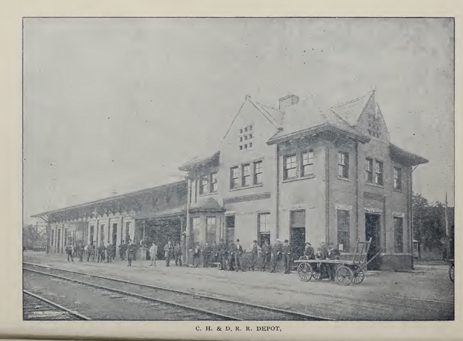
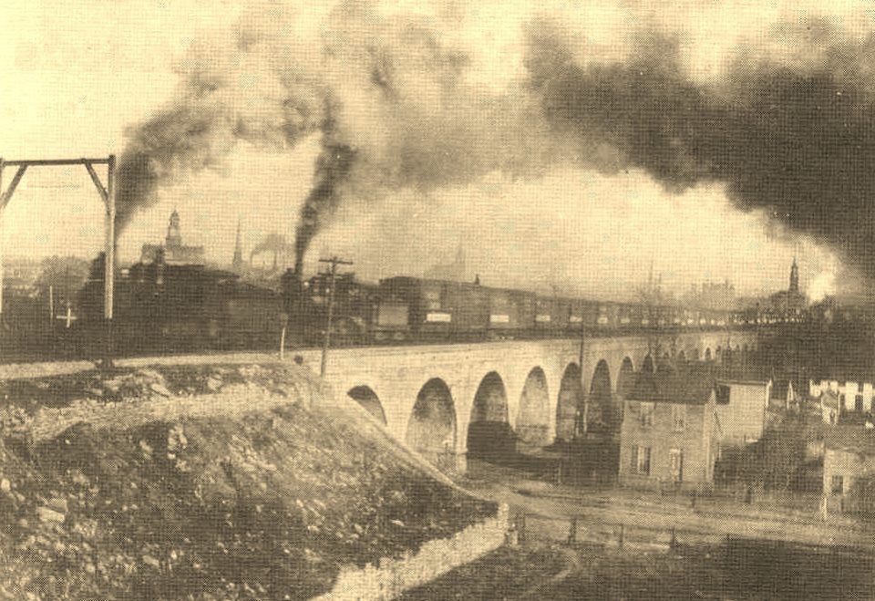
These later historic views help visitors visualize Hamilton's railroad geography while the route page is still being built. They are contextual images and should not be mistaken for photographs of a specific Underground Railroad journey.