Hamilton UGRR logo CONTACT
Downtown Hamilton • Six-Stop Working Walking Tour

Walk the Hamilton Story

The downtown tour is organized into six practical stops, beginning at the historic jail site and ending at the railroad crossing. The map uses present-day streets and navigation points while the text distinguishes modern orientation from what the historical evidence actually proves.

Historic site vs. modern navigation point

Some buildings survive on the same site, some have been replaced, and some exact parcels remain unresolved. A map pin tells a visitor where to stand today. It does not automatically prove that the modern address is the exact 1854 footprint.

Current map

Current Google Map • All Six Stops

The embedded map uses today's Hamilton street map and a walking-route view between the six current navigation points. The Google route is for modern wayfinding only, not a reconstruction of the exact historical walking path.

Open All 6 Stops in Google Maps →
Safety: Stop 6 is a railroad corridor. View the arches and crossing only from public streets and sidewalks. Do not enter railroad property or climb onto the tracks.
The six-stop walking sequence

Stops matched to the map

1
Detention • Direct event site

Site of the 1846 Butler County Jail
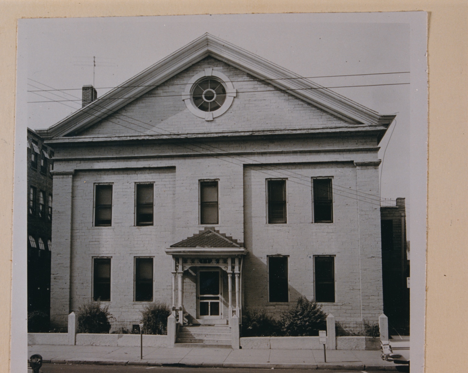
Historic photograph of the Butler County Jail in Hamilton, Ohio
Historic Butler County Jail. Photo used courtesy of the George C. Cummins “Remember When” Photograph Collection at the Hamilton Lane Library.

After his arrest, the freedom seeker was transported by dray to the county jail. The jail then in service had been erected in 1846 on Lot 84 immediately south of the public square, fronting Basin Street, today's Court Street.

Current navigation point: 105 Court Street, the U.S. Post Office property / parking area used to orient visitors to the historic jail parcel vicinity.
Evidence caution: The map pin is a practical present-day stopping point. It should not be read as a claim that the entire 1846 jail footprint is identical to the modern Post Office parcel.
Documented detention siteExplore the jail →
2
Habeas corpus • Direct event site

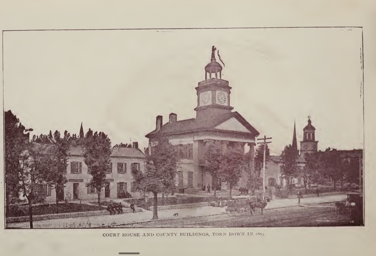
Butler County Courthouse

Historic Butler County Courthouse and county buildings
The courthouse complex associated with the 1854 case. The present courthouse postdates the 1854 building, but the public-square civic site has continuity.

Attorneys N. C. McFarland and John R. Lewis sought habeas corpus relief before Judge Thomas H. Wilkins. Contemporary reporting records the man's release and departure with several Underground Railroad conductors.

Current address: Butler County Courthouse, 101 High Street, Hamilton.
Documented legal-action siteExplore the courthouse →
3
Interpretive stop • Presbyterian legal network

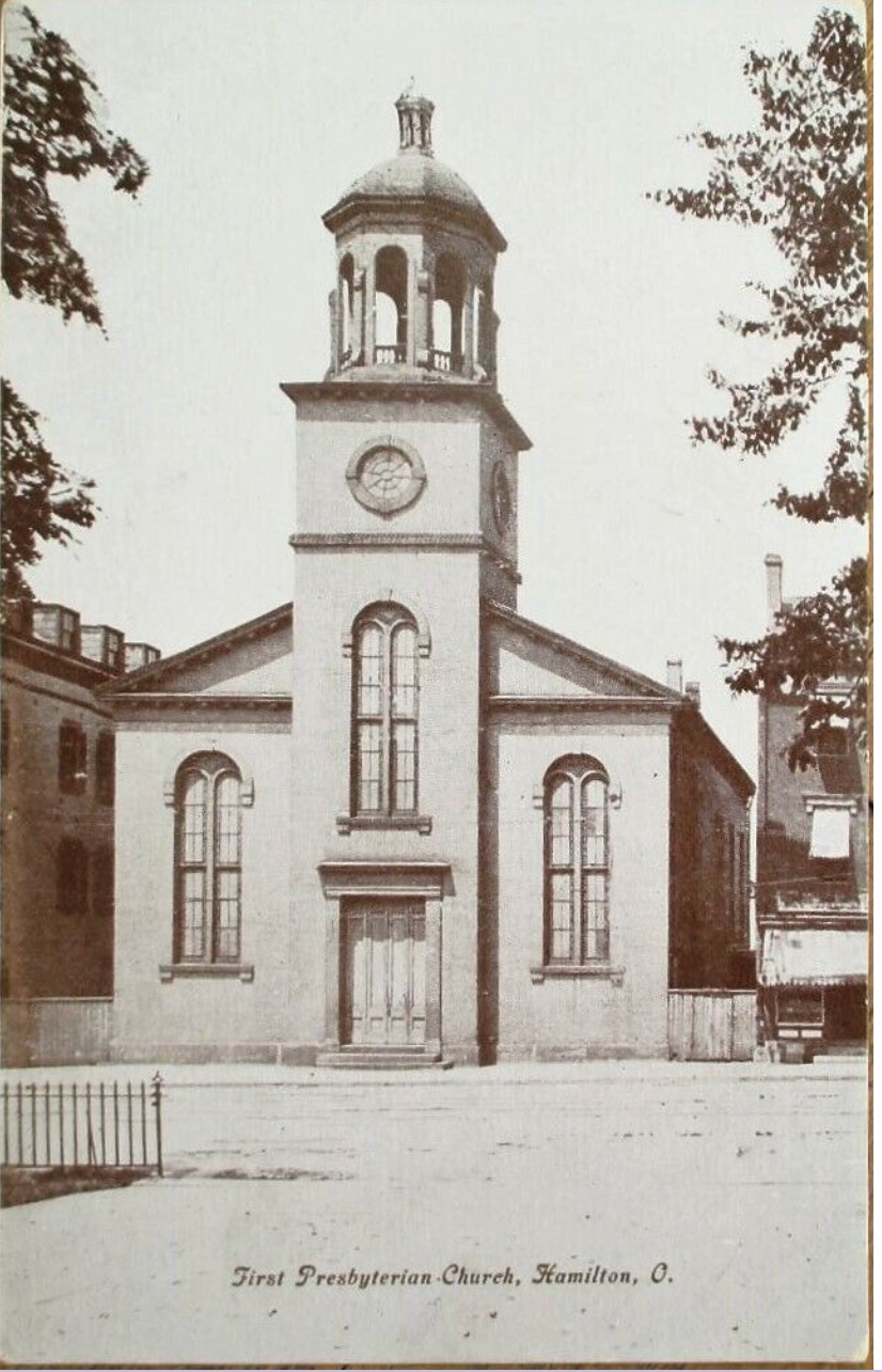
First Presbyterian Church

Historic postcard view of First Presbyterian Church in Hamilton
First Presbyterian on the Front Street site. The present main structure was completed in 1855 on the same site where the 1838 church stood during the July 1854 case.

This stop explains the church network behind the legal intervention. John R. Lewis and Noah C. McFarland were documented First Presbyterian leaders as well as the attorneys who intervened in the 1854 case.

Current address: 23 South Front Street, Hamilton.
Interpretive purpose: The freedom seeker is not documented as entering this church. The stop is included because of the documented church leadership of the lawyers who acted for him.
Documented network contextExplore First Presbyterian →
4
Interpretive stop • Associate Reformed network

Court Street Church Site

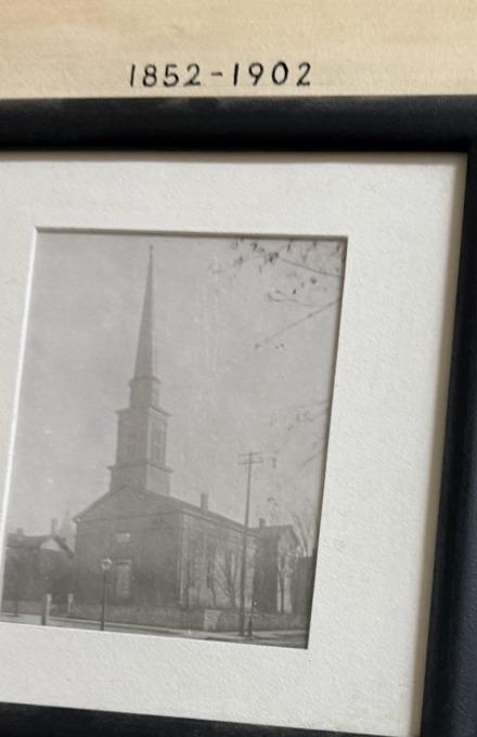
Historic Associate Reformed and United Presbyterian church building in Hamilton
The 1852-1902 church. This was the church building standing during the principal Underground Railroad period discussed on the site.

This stop explains the John Woods, Mark Campbell McMaken, David McDill, and William Davidson network. McMaken said freedom seekers were generally directed to Woods in Hamilton and identified the Associate Reformed and Presbyterian congregations as containing Hamilton's active antislavery people.

Current address: 23 Court Street, Hamilton. The present building is later, but the congregation's Court and Water Street site dates to 1828.
Interpretive purpose: This is network context, not evidence that the freedom seeker entered the church during the 1854 case.
Documented network contextExplore this place →
5
Black community • Concealment

Alfred J. Anderson's First Ward / Water Street Area

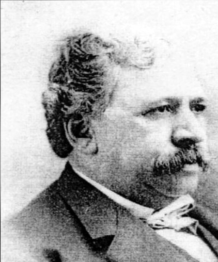
Historical portrait of Alfred J. Anderson
Alfred J. Anderson. McMaken remembered Anderson taking charge of the released freedom seeker and concealing him until night.

Later property evidence places Anderson in Hamilton's First Ward near the Water Street corridor, now South Monument Avenue. The exact 1854 hiding building remains unresolved.

Current navigation point: South Monument Avenue at Pershing Avenue, used to orient visitors to the historic First Ward / Water Street area rather than to claim an exact hiding property.
Documented action • Exact property unresolved
6
Escape route • Direct route site

Great Miami Railroad Crossing

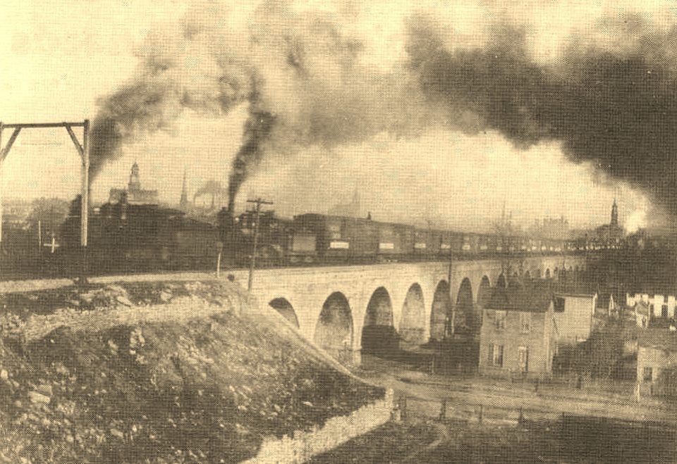
Historic train on Hamilton's west-side railroad masonry arches
The railroad approach in a later historic view. Surviving masonry arches preserve part of the historic west-side crossing corridor.

McMaken specifically remembered that after dark “we crossed the river on the railroad bridge.” The present river bridge is later, but the corridor and surviving masonry approach preserve the geography of that movement.

Current viewing point: South B Street at Arch Street. Remain on public streets and sidewalks; the railroad itself is active private property.
Documented route corridor
Reviewer question

Does this six-stop sequence feel like the right public walking-tour structure? A future map refinement could replace the route-style Google embed with a dedicated public map layer so the six numbered pins can carry the same titles and descriptions directly inside the map.